Australia
Byford
|
|
Cohunu Koala Park
|
Cairns
|
|
Cairns Rainforest
|
|
|
Great Barrier Reef
|
Cervantes
|
|
Lobster Shack
|
Corrigan
|
|
Corrigan Dog Cemetery
|
Fremantle
|
|
Fremantle Prison
|
|
|
Round House
|
|
|
Western Australia Maritime Museum
|
Hillarys
|
|
AQWA
|
|
|
Grey Nurse Shark
|
Hyden
|
|
Hippo's Yawn
|
|
|
Mulka's Cave
|
|
|
Wave Rock
|
Lancelin
|
|
Lancelin Sand Dunes
|
|
|
Sandboarding
|
Mandurah
|
|
Boardwalk
|
|
|
Indo-Pacific Bottlenose Dolphins
|
Nambung
|
|
The Pinnacles
|
Penguin Island
|
|
Boardwalk
|
|
|
Little Penguins
|
|
|
Seal Island
|
Perth
|
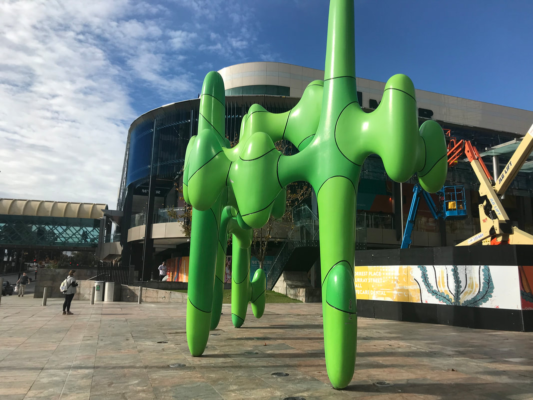
The Cactus
|
|
Caversham Wildlife Park
|
|
|
|
Crown Perth Casino
|
|
Elizabeth Quay
|
|
|
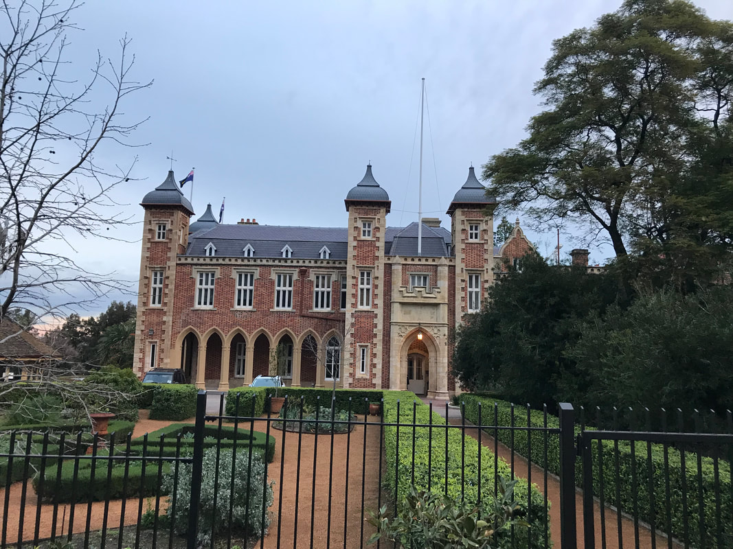
Government House
|
|
His Majesty's Theatre
|
|
|
|
Humpback Whale
|
|
King's Park
|
|
|
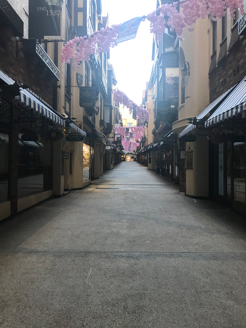
London Court
|
|
Optus Stadium
|
|
|
|
Oysters & Pearls
|
|
Perth Art Gallery
|
|
|
|
Perth Cathedral
|
|
Perth Mint
|
|
|
|
State War Memorial
|
|
Swan Bells Tower
|
|
Rockingham
The city received its name from the sailing ship Rockingham, one of the three vessels that Thomas Peel chartered to carry settlers to Western Australia. The Rockingham was beached in 1830 and eventually abandoned after failed attempts to re-float her. Settlers supposedly camped near the wreck used the name "Rockingham Town" as their address. Rockingham was first surveyed and lots were offered for sale in 1847. It was not until the development of a railway and jetty in 1872 to transport jarrah timber and sandalwood from Jarrahdale overseas however, that it prospered. In 1908 the timber port closed due to the opening of deeper ports like Fremantle. Fortunately though this coincided with the arrival of the motor car which gave impetus to the rapid development of the little coastal settlement into a seaside resort town.
|
|
Indo-Pacific Bottlenose Dolphins
Indo-Pacific bottlenose dolphins are very similar to common bottlenose dolphins in appearance. Common bottlenose dolphins have a reasonably strong body, moderate-length beak, and tall, curved dorsal fins; whereas Indo-Pacific bottlenose dolphins have a more slender body build and their beak is longer and more slender. The Indo-Pacific population also tends to have a somewhat lighter blue colour and the cape is generally more distinct, with a light spinal blaze extending to below the dorsal fin. However, although not always present, the most obvious distinction can be made with the presence of black spots or flecks on the bellies of adults of Indo-Pacific bottlenose dolphins, which are very rare in common bottlenose dolphins. Their teeth can number between 23 and 29 in each upper and lower jaw, and are more slender than those of common bottlenose dolphins. Size of Indo-Pacific bottlenose dolphins can vary based on geographic location; however, its average length is 2.6 m (8.5 ft) long, and it weighs up to 230 kg (510 lb). The length at birth is between 0.84 and 1.5 m (2.8 and 4.9 ft). It lives in the waters around India, northern Australia, South China, the Red Sea, and the eastern coast of Africa. |
Rottnest Island
Rottnest Island’s history extends as far back as 50,000 years ago, when it was still connected to the mainland of Western Australia. Aboriginal artifacts suggest there was significant human occupation until ~7,000 years ago when the rising sea levels resulted in the separation of the island. Without boats Aboriginal people on the mainland weren’t able to make the crossing, leaving the island uninhabited for the next several thousand years. Rottnest Island features in Noongar Aboriginal mythology as Wadjemup, meaning "place across the water where the spirits are". After separating from the mainland, the island remained uninhabited until 13 Dutch sailors from the Waeckende Boey landed near Bathurst Point on the 19 March 1658. This marked the beginning of the European exploration and settlement on the island. In 1696, Dutch captain Willem de Vlamingh spent 6 days exploring the island before giving it the name 't Eylandt 't Rottenest ("Rats' Nest Island") after the quokkas which he mistook for giant rats.
A couple hundred years later, William Clarke and Robert Thomson received land grants from the British Swan River Colony for pasture land and town lots to be built on the island. In 1831 Thomson moved his family to the island and began building up the island’s main settlement at Thompson Bay. Pasture land for hay production was developed west of Herschel Lake, while several salt lakes were harvested and the salt was exported to the mainland.
A couple hundred years later, William Clarke and Robert Thomson received land grants from the British Swan River Colony for pasture land and town lots to be built on the island. In 1831 Thomson moved his family to the island and began building up the island’s main settlement at Thompson Bay. Pasture land for hay production was developed west of Herschel Lake, while several salt lakes were harvested and the salt was exported to the mainland.
|
Bickley Gun Tower
While the big guns were designed to keep enemy ships at bay, Rottnest was also well prepared for a possible invasion of the Island. The shelter was used by the gun crew to rest when off-duty and to take cover if the Battery was under attack. Today nature is allowed to take over. Rather than trying to conserve all of Rottnest’s military heritage sites in pristine condition, this approach helps us to appreciate the change of times. The Bickley gun barrels likewise experienced a change of times. In 1963 they were cut up for scrap metal but were too heavy for transport. |
|
|
|
Quokka
During the Pleistocene period, quokkas were more abundant and living on open landscapes. When the Europeans arrived in Australia, they introduced new species, some of which became predators to the quokkas. This caused the habitats of quokkas to eventually shift to islands and forests, where there were minimal predators and more vegetation. In the wild, the quokka's roaming is restricted to a very small range in the South West of Western Australia, with a number of small scattered populations. One large population exists on Rottnest Island and a smaller population is on Bald Island near Albany. The islands are free of certain predators such as red foxes and cats. On Rottnest, quokkas are common and occupy a variety of habitats, ranging from semiarid scrub to cultivated gardens. Prickly Acanthocarpus plants, which are unaccommodating for humans and other relatively large animals to walk through, provide their favorite daytime shelter for sleeping. Additionally, they are known for their ability to climb trees. |
|
Kingston Army Barracks
There's a group of old Army brick-buildings in the southeast corner of the island called Kingstown Barracks. According a bronze plaque the Army officially occupied the site between 30 June 1936 and 14 December 1984, after which the Western Australian Government was handed the keys. But the Army had been secretly at work much longer. By 1934 it possessed detailed plans of its intentions. Furthermore, it had selected the name Bickley Point Fort. When this became known, the conservative Royal WA Historical Society successfully lobbied for Kingstown, which was a hangover from 1830s British colonial cartography. The barracks were built from red bricks manufactured east of Perth. Apparently the original design only accommodated about 76 soldiers, then alterations were made to double the number to 150. However during WW2 there were over a couple of thousand military personnel under canvas at other places on the island. Nowadays the entire facility looks quite austere, and has mostly been empty of people when I've visited it. |
|
|
|
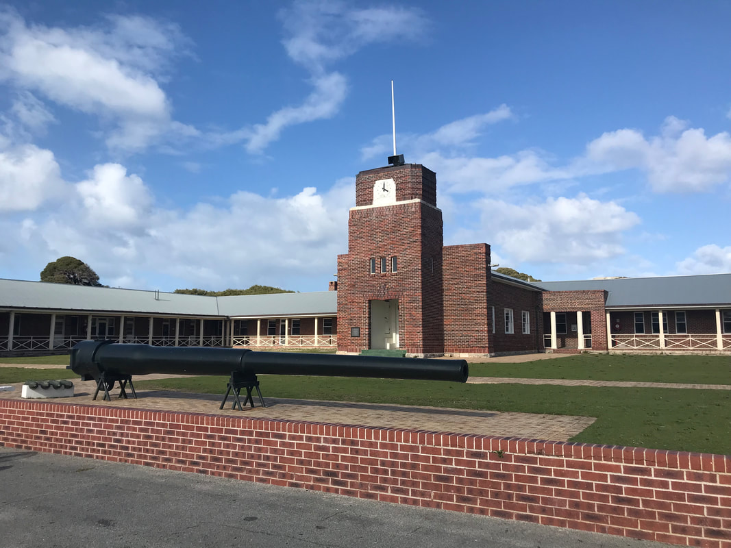
Oliver Hill Gun Tower
The Oliver Hill Battery, in the centre of Rottnest Island, was installed in 1938 and operated two 9.2-inch naval guns. It was tasked with the long-range defence of Fremantle Harbour. The battery operated until October 1944, when it was shut down and its personnel assigned other duties. In addition to the battery, a large support infrastructure was installed on the island, which mostly remains intact today. Accommodation was provided at Kingstown Barracks while supplies were unloaded at the Army Jetty and brought up to the battery via the Oliver Hill Railway. A number of observation posts were also constructed |
|
Rottnest Preserve
After Rottnest was proclaimed as an A-class Reserve in 1917, management was vested in the "Rottnest Island Board of Control" which continued until 1956. Rottnest Island was declared an A class reserve under the Permanent Reserves Act in May 1917. A Board was then appointed under the Parks and Reserves Act to control and manage the island (excluding the lighthouse and prison reserve). The Board of Control became a Body Corporate in 1956 and became a Board of Management. The island has been identified by BirdLife International as an Important Bird Area (IBA) because it supports important breeding populations of the fairy terns (200-300 breeding pairs), over 1% of the non-breeding population of banded stilts (with up to 20,000 birds) and regionally significant numbers of wedge-tailed shearwaters and red-necked stints. Rottnest was often described as heavily wooded by early explorers. Nearly 200 years of farmland clearing, firewood collection and bushfires has denuded much of the 19 square kilometres (7.3 sq mi) of large trees, and a fragile and fresh water-scarce environment has limited natural recovery. A conservation program including reforestation is ongoing. An island-based nursery propagates plants with island provenance used in the reforestation program and in remediating uncontrolled beach access. |
|
|
|
Watch Tower
In response to increasing global tensions in the 1930s, the Australian government developed a three-year Defence Development Program that it commenced in 1933. In the Plan, Rottnest Island was identified as being critical to the defence of Fremantle as guns there could engage hostile ships well before they approached the range that would allow bombardment of Fremantle Port. In 1934 the Western Australian Premier officially informed the Rottnest Island Board of Control of the Commonwealth's intentions for a defense program on Rottnest Island and in 1936 it purchased land at Bickley for this purpose and construction began later that year. In the mid-1940s, the focus of threat moved to Northern Australia, so the fixed defenses at Rottnest Island were reduced. The 9.2-inch guns were put on a maintenance basis and only the 6-inch guns at Bickley remained manned. The period of intensive military activity on Rottnest Island ended with the guns never being fired at the enemy. |
Swan Valley
The Swan Valley is a geographical area situated between the Swan and Helena River confluence and Walyunga pool in the Darling Range. It occupies an area of 105 square kilometres. When the Dutch explorer, Willem de Vlaming, ventured up the river as far as Perth in 1697, he noticed the large number of black swans there and named it the Swan River. Although the French travelled up the Swan River as far upstream as Whiteman Bridge in 1801, it wasn't until 1829 that European settlement occurred, following Captain James Stirling's exploratory voyage in 1827.
Initially the Swan River was the only transport route, and locations to settlers were long and narrow to give everyone a river frontage. The input of convict labour in the area between 1850 and 1868 was critical for the establishment of roads and the building of Barkers Bridge and the Upper Swan Bridge. The expansion of the railways in the 1880s, the increase of population in the 1890s after the gold rushes and European immigration saw the start of the subdivision of many of the large estates in the Valley in the 1900s. By the 1920s, the Swan Valley had achieved a position of clear dominance as a vineyard district, particularly for table grapes and dried fruit. Post World War II saw increasing importance on wine production and by 1979 there were 38 wineries in the Swan Valley. Today the number of wineries continues to grow and in 2014 the region celebrated 180 years of winemaking.
Initially the Swan River was the only transport route, and locations to settlers were long and narrow to give everyone a river frontage. The input of convict labour in the area between 1850 and 1868 was critical for the establishment of roads and the building of Barkers Bridge and the Upper Swan Bridge. The expansion of the railways in the 1880s, the increase of population in the 1890s after the gold rushes and European immigration saw the start of the subdivision of many of the large estates in the Valley in the 1900s. By the 1920s, the Swan Valley had achieved a position of clear dominance as a vineyard district, particularly for table grapes and dried fruit. Post World War II saw increasing importance on wine production and by 1979 there were 38 wineries in the Swan Valley. Today the number of wineries continues to grow and in 2014 the region celebrated 180 years of winemaking.
|
Margaret River Chocolate Factory
The Margaret River Chocolate Company is one of Western Australia's most popular tourist attractions, established more than 20 years ago as the first of its kind in the region and now with manufacturing, sales and cafe facilities in Margaret River and the Swan Valley and a concept store in the heart of the Perth CBD. The original Margaret River factory is located on a peaceful and picturesque rural property just 20 minutes from Margaret River and Busselton with plenty of parking. It provides a fascinating insight into the world of chocolate, and visitors are treated to free chocolate tastings, interactive displays, viewing windows to watch the chocolate products being made and a friendly atmosphere. A wealth of information on all aspects of chocolate is available, plus both factories sell a huge, mouth-watering range of chocolate bars, chocolate-coated delights, hand made truffles, novelty chocolates, chocolate body products, chocolate sauce, cookies, ice-cream, chocolate milk and a variety of chocolate cakes. |
|
|
|
Swan River
In 1697 Willem De Vlamingh named the Swan River after the large flocks of black swans which inhabited the area. The original name was actually 'Swartte Swaane Drift' (Black Swan River). Francis-Antoine Boniface Heirisson was the first person to draw a detailed map of the river in 1801 and Heirisson Island - where the causeway crosses) was named after him. When James Stirling gave the river the English name 'Swan River', he only applied it to that portion of the river upstream of Heirisson Island. The section from the island downstream to Fremantle was referred to as Melville Water - a name that is still used today - although now the name Sawn River encompasses both sections. It is more correct to refer to the down stream area as the Swan Estuary. |
|
Wineries
The Swan Valley wineries have been making wine for over 180 years, the second oldest wine region in Australia. Grape vine cuttings were bought by the British settlers in 1829 from the Cape of Good Hope. A small quantity of wine was made in 1834 from a vineyard near the Swan River. Later settlers grew grapes and had orchards along the fertile banks of the Swan River. Some of the names that remain today are Olive Farm and Sandalford. |
|
York
The word Noongar describes people whose ancestors first occupied and now continue to occupy the South West region of Western Australia. The Ballardong people are a specific Noongar language group east of Perth. There are a number of Registered Aboriginal Heritage Places within the Shire of York, including the Avon River. Although fragmented by the effects of settlement, Ballardong Noongar culture and identity survives and is gaining wider recognition within the community. Spiritual and traditional ties to Country are deeply felt by Ballardong people today and are acknowledged by the Shire of York.
York is the oldest inland town in Western Australia, being situated approximately 97 kilometres by road east of Perth in the Avon Valley, which is one of the most fertile areas of the State. The Swan River Colony was settled by the British in 1829, founding the State of Western Australia. The first explorers saw a resemblance between the valleys traversed and the county of Yorkshire in England. It was decided by the Governor that Yorkshire should be the name given to the district and that York should be the name of the first town.
York is the oldest inland town in Western Australia, being situated approximately 97 kilometres by road east of Perth in the Avon Valley, which is one of the most fertile areas of the State. The Swan River Colony was settled by the British in 1829, founding the State of Western Australia. The first explorers saw a resemblance between the valleys traversed and the county of Yorkshire in England. It was decided by the Governor that Yorkshire should be the name given to the district and that York should be the name of the first town.
|
|
York Town Hall
York Town Hall is a heritage listed town hall in York, Western Australia, located in Avon Terrace. At the time of its construction, it was claimed to be the largest public hall in Western Australia, with an interior floor space measuring 100 by 50 feet (30 m × 15 m). Constructed in 1911, it is an example of Edwardian opulence. Architecturally, while it may be considered to be in Federation Free Classical style. The Town Hall was opened on 30 November 1911 by the newly elected Labor Premier John Scaddan. |
