|
I’m in California for work again. This time though we decided to meet us in the Orange County offices since there is some big convention going on in San Francisco this week and the hotel prices were outrageous. Still, it gave me a chance to explore Los Angeles.
Afterwards I was supposed to go to Griffith Observatory, but I was tired so I decided to save that for another day and went to the hotel instead. I’m ready for my next adventure tomorrow!
0 Comments
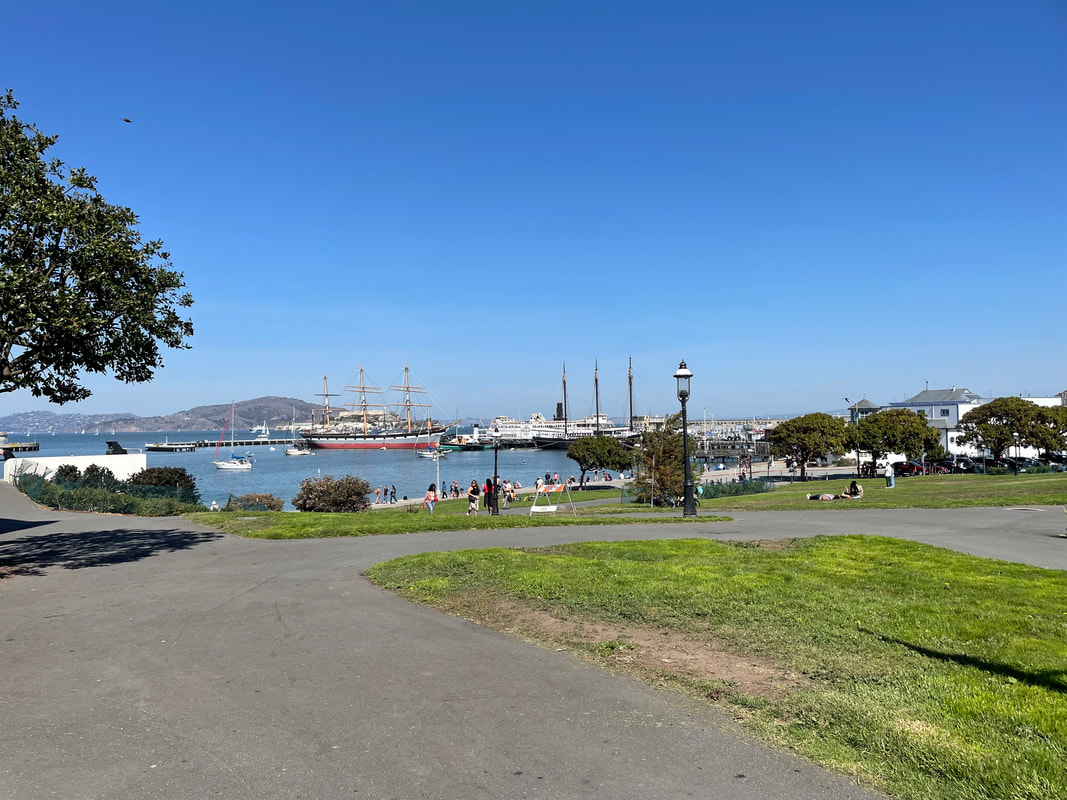
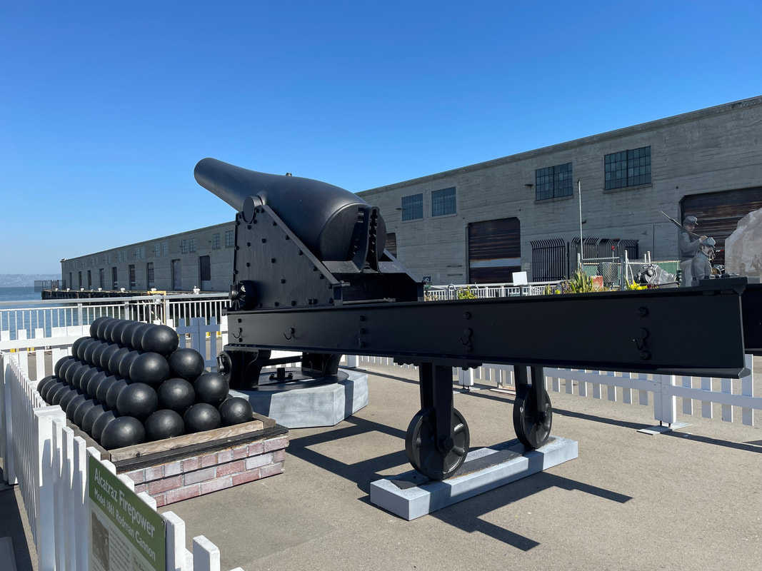
The fort was built just before the start of the Civil War. It was built to protect the San Francisco Bay, but never saw battle. There was also an increased soldier presence during World War II to guard against minefields and submarines. When the Golden Gate Bridge was being designed, the fort was almost demolished to make way for the bridge. But Chief Engineer Joseph Strauss redesigned the bridge to save the fort, where it still remains.
After I finished walking around, I still had plenty of time before my flight. I decided to grab a bite to eat at the café. That was a mistake. First of all, I didn’t realize that all of the food would be plant based. So I paid for an overpriced sandwich that didn’t have any meat, and instead had beets acting like meat. I learned my lesson and decided to eat at the airport instead. Otherwise, it was a nice flight home.
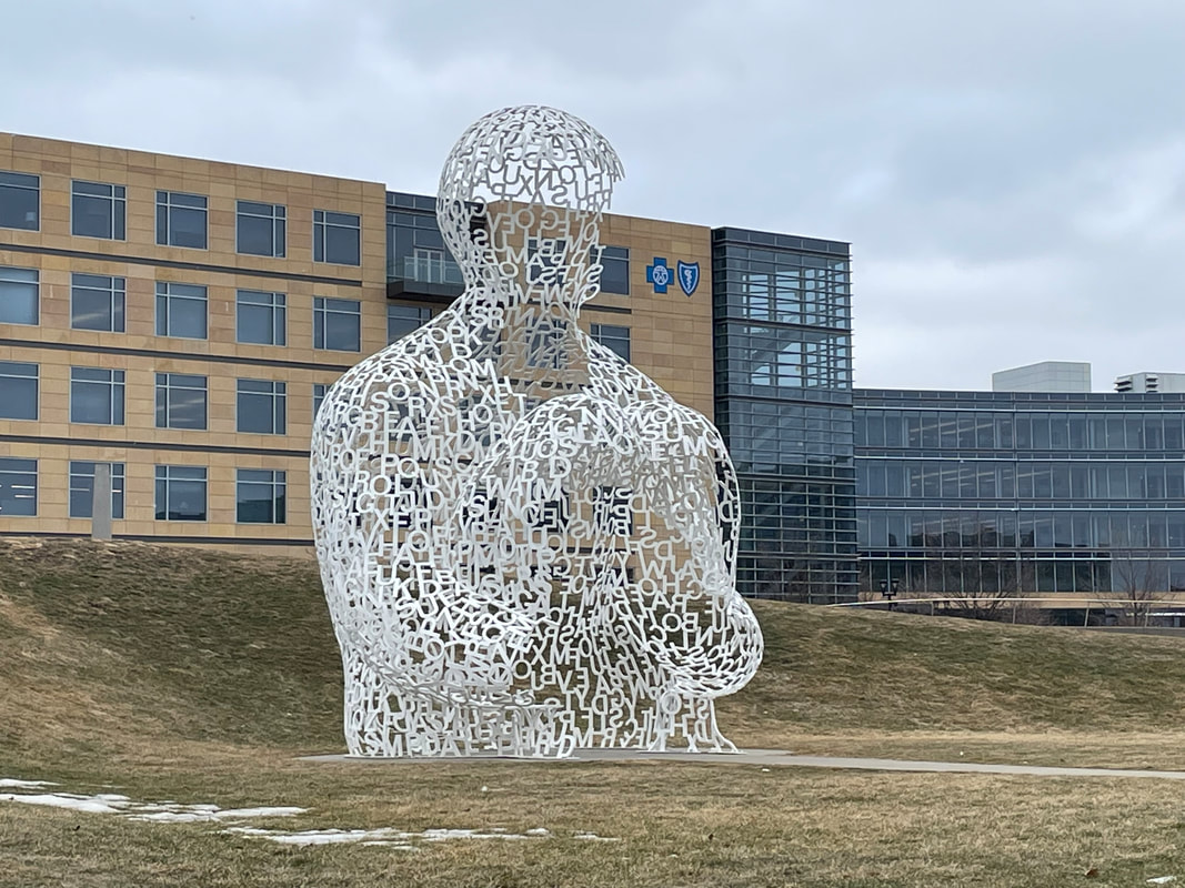
I’m in Des Moines for the first time on a client. We have been here the past week and the rest of the team is flying back this afternoon, but I decided to stay an extra day and fly back tomorrow. So I traveled with them to the airport, and while they went to check in, I grabbed my rental car and went back out.
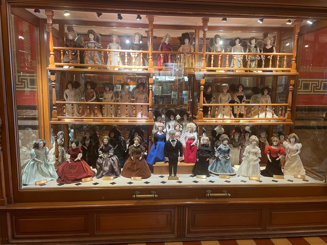
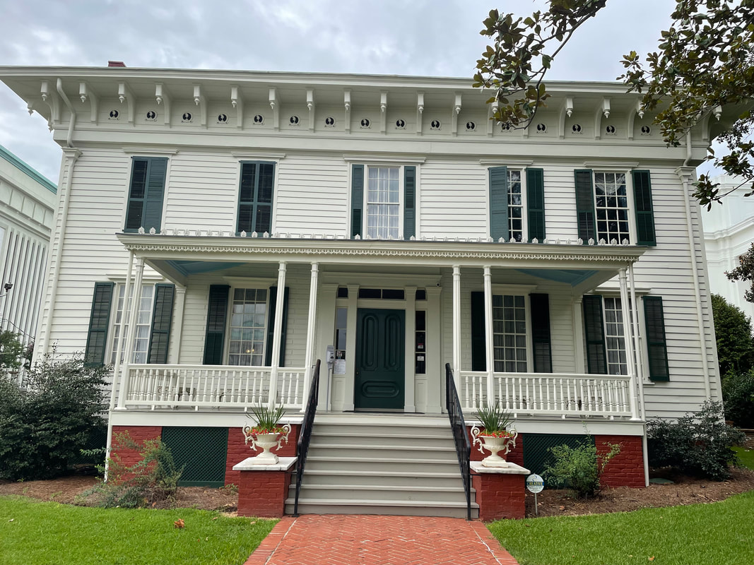
I was hoping to be there in time for the tour, but it either wasn’t running today or I missed it. Still, there was a QR code that took you on a walking tour of all of the rooms. The rooms were beautiful! I loved the wood paneling and tapestries. It definitely was like a European house, which wasn’t a surprise as that is what it was modeled after. Salisbury House was built in the 1920s by cosmetics magnate Carl Weeks and his wife Edith. The house was modeled after the King’s House in Salisbury England.
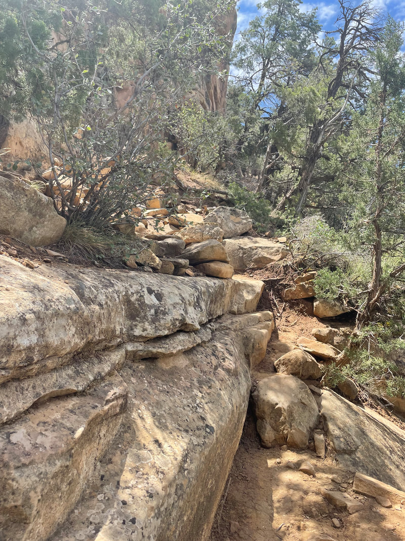
I’m still visiting my parents after coming home for the holidays. Mom is also off today, so we decided to go hiking. I ordered us a pass for Garner State Park and we decided to take Buddy, my new dog. We got up early, got dressed and headed out to enjoy our hike. Once we got there, we decided we were going to hike up Old Baldy, so we started up the trail. I did not realize how hard it would be to hike with a dog. First of all, Buddy wanted to meet all of the other dogs also hiking and he kept pulling on his lease. The other issue was that it has rained the night before, so everything was wet. And finally, I couldn’t use my hiking poles because I had to hold onto Buddy’s lease. Needless to say, we didn’t get far. We finally threw in the towel when we were going up, and Buddy decided to run up the incline while my feet slipped on the wet rocks and I was slowly sliding down. I had to let Buddy’s leash go, but luckily he ran to Mom and she was able to grab him. We decided it was too dangerous to continue so we went back down.
I have an afternoon flight back home today. I’ve kept Texas hours by waking up early, but there really isn’t much open this early. So I worked some more before it was time to leave for the airport. And then it was a 4 hour flight home. I really enjoyed seeing California finally, but I’m glad to be back home.
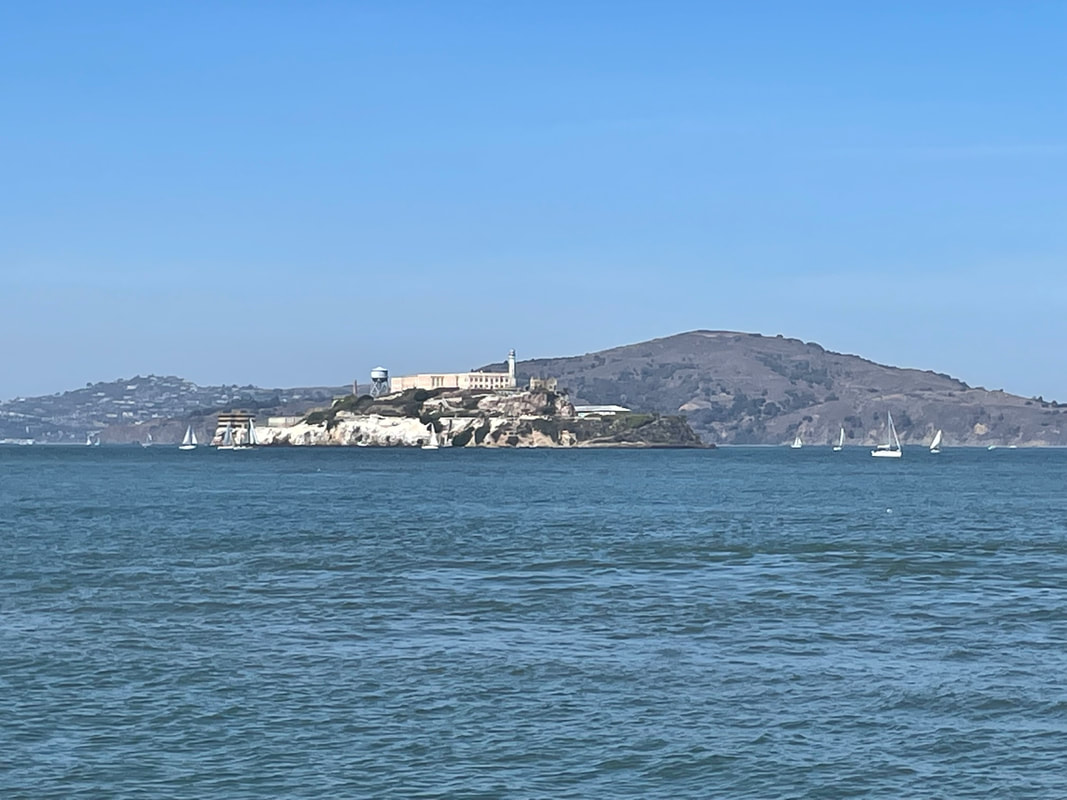
The boat didn’t take long to get to the island. Once we got off, there was a short orientation from the park rangers, just letting us know a little history about the site. It was originally a fort to protect the bay, but it was later converted into a federal prison in 1934. It became one of the most famous ones in history as it was nearly impossible to escape because it was on an island and the strong cold current made any attempt deadly. The prison closed in 1963. In 1969, the island was occupied by a group of Native Americans for 19 months who were part of a group organizing public protest.
One of the stories was dedicated to the escape attempts from Alcatraz. There were several but the most famous was made by Frank Morris, John Anglin, and Clarence Anglin. They even made a movie of it. The 3 had neighboring cells and spent 6 months widening the ventilation ducts beneath their sink. They then had access to the unguarded utility corridor and made life preservers from stolen materials. To conceal that they weren’t in their cell, they made paper mâché heads so it would look like they were asleep in their bunks. They were never seen from again. The FBI investigated and believed they drowned, but no body was ever discovered. I feel like they did so much planning, that they probably made it.
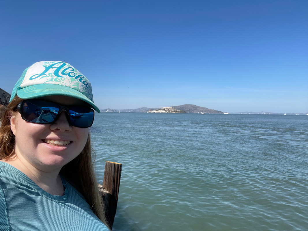
The islands can only be reached by boat, and they had different options available. You can on the islands or you can take a boat tour that goes around all the islands, which is what I decided to do since I was limited on time. I had originally planned on spending the day here, but it got pushed back because I decided to go to Disney yesterday.
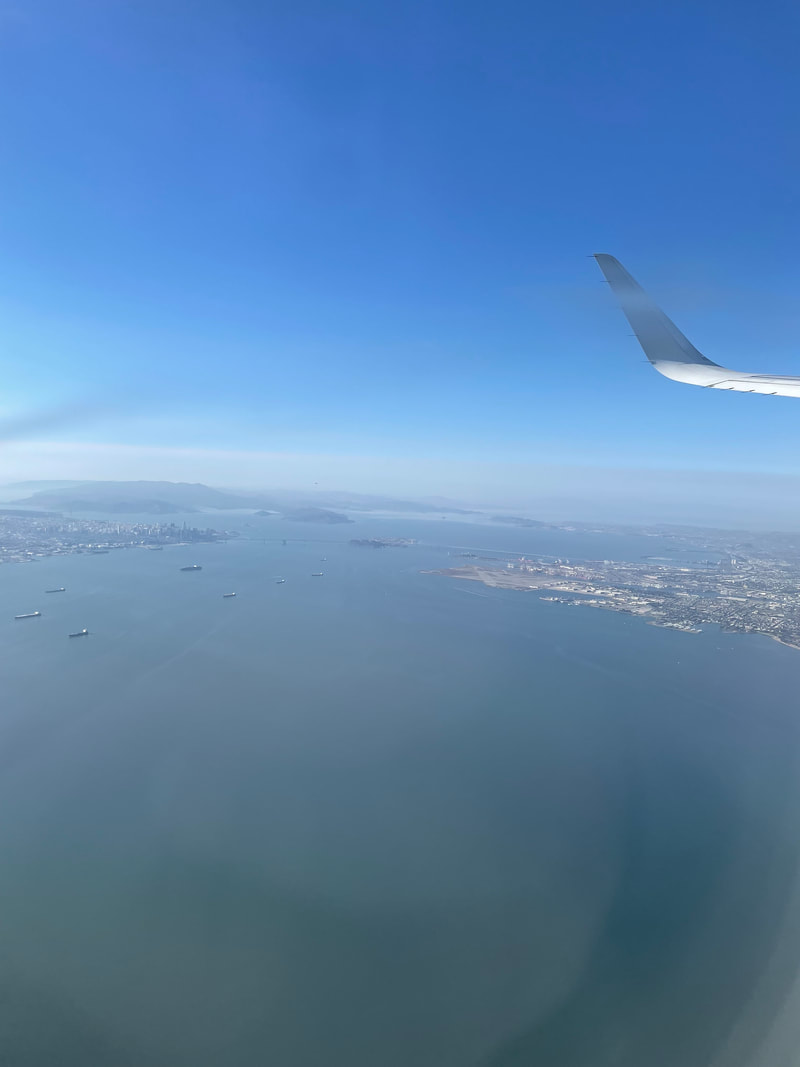
After I got back, I got in my car and drove to Santa Monica Mountains NRA’s visitor center. When Jaime and I visited the mountains last weekend, we didn’t go to the visitor center so I couldn’t get the stamp for my book. I hurried in there, got the stamp, and left. By this time I realized I would be rushing to catch my flight in time. My flight left at 4:20, but I didn’t count on LA traffic. I also didn’t count on the fact that the rental car place was separate from the airport. So I had to turn in my car, get on their bus to the gate, go through security, and then take another bus to my gate. I was panicking because I didn’t think I would make it in time. Luckily, I made it with 10 minutes to spare before they started boarding. After that, it was smooth sailing to San Francisco.
It worked out very well. As soon as the show ended, I was part of the first wave of people going to their car so I didn’t have to wait a super long time, maybe 40 minutes all together. When I got to my car, I hurried to the exit and then started my drive to a hotel by the Channel Islands, which is where I’m going tomorrow. It was a mistake to get a hotel so far away. Getting to Disney early and walking around drained me more than expected. Plus all of the late nights working this past week didn’t help. I shouldn’t have been driving. I could feel myself falling asleep. I tried everything to stay awake, rolling down my windows and blaring the music. Finally I made it to my hotel around midnight CA time and could get to sleep. I later found a yellow line on my rental car, like the yellow pain on concrete barriers. Jaime said she didn’t hit anything and I don’t remember seeing it when I got the car. I think I sideswiped something on that drive, so I’m lucky to be alive.
The two Harry Potter rides were opposite each other, so I decided to ride the Flight of the Hippogriff first. It was a traditional roller coaster ride that went around the pumpkin patch and around Hagrid’s hut. I got to skip the line since I paid extra for the Universal Express, which let me skip the line on 3 rides. It was a very short ride.
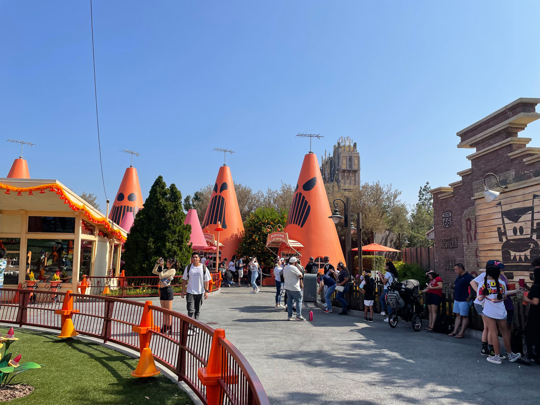
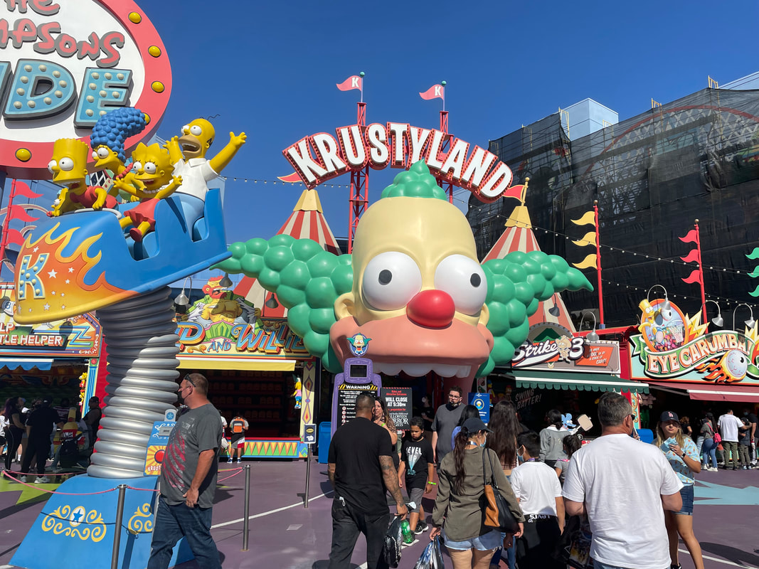
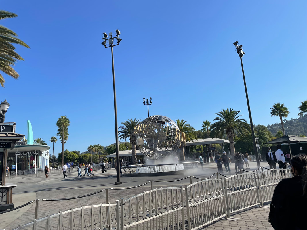
I’m in California this week for work. My client is actually in San Francisco, but they are still shut down due to Covid. Since the full team can’t go to their office, we are instead meeting up at the Orange County office. Since we finally made it to California, Jaime and I decided to fly out early and enjoy ourselves a little. I had to take the GMAT the morning of the flight in order to get into college, so I decided to take an afternoon flight. Jaime decided to take the same flight as well. We both flew into LAX, because we wanted to see Los Angeles.
We found a restaurant that looked good online, but when we got there the parking lot was full. We circled for a while but couldn’t find a place to park. So we decided to continue on and eat after going to Griffith Observatory. We found the lane to turn into the Observatory and it took forever to get up there. There was a huge line! We waited in it for over an hour. Apparently there was a concert going on at the amphitheater down the hill from the Observatory. By the time we realized it and wanted to give up, it was too late. We literally could not escape the line of cars since we were blocked in on all sides. We finally got to the top where the observatory was, and there was no parking. We finally gave up and headed back down. All of that time waiting for nothing. We tried to stop at a Raising Cane, and the line was wrapped around the building and all the way out on the street. We just went back to the hotel because we were exhausted by that point.
Our one plan was to get back to Dallas as soon as possible today so we could turn in the rental car and then relax. It took a while, but we didn’t hit any more large traffic jams along the way. We got the rental car returned with no issues. At least I’m home now. I feel bad for Mom who still has to drive back to San Antonio tomorrow. It was another great vacation!
By the time I woke up, Mom already had the car loaded and was ready to go. She was ready to get on the road since we had agreed to leave early. So I quickly got dressed and packed so we could hit the road. We had a long drive ahead of us. We decided to head straight south through and go through Albuquerque on the way home this time. There are 2 national monuments around Albuquerque. The first one we stopped at was Aztec Ruins National Monument. When we got there, we went inside so I could get a stamp for my book. The rangers told us about the self-guided tour through the ruins. As we got to each stop, we stopped to listen about the history of the place. The ruins were built and occupied over 900 years ago by the Ancestral Pueblo. It is the largest Ancestral Pueblo community in the Animas River Valley. We got to see buildings such as the “great kiva”, which is a large circular ceremonial chamber.
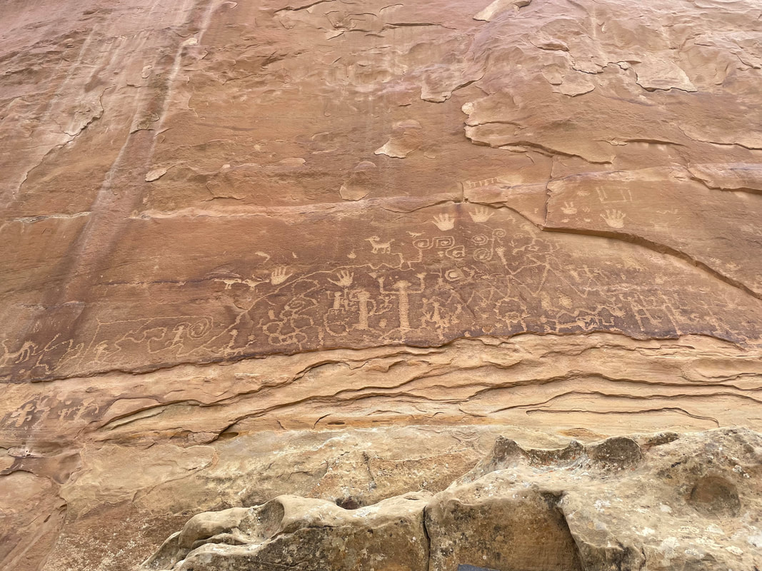
Our next stop was Petroglyph National Monument. The place the map took us was just a building. Due to covid, they weren’t allowing people inside, but I was able to get a map and my stamp outside. According to the park ranger, there were no actual petroglyphs located where the building was, but there were several walking trails in the area where you could see them. They also had a video playing outside about the sites. We stayed for a little while to watch the video. The video talked about the history of the petroglyphs. They were carved long ago and the meanings of the symbols have changed over time and have been lost to history. They went through some of the current meanings, but I don’t remember what they were.
That was the last stop we made to tour things. We got on Highway 40, and then it was a straight shot to Amarillo. In one spot we hit a ton of traffic and crawled along for over an hour. It led to us not getting as far down the road as we wanted to before we stopped for the night, but we knew we would have to stop at some point. While we were in traffic I scouted ahead and found a Hilton for us to stay the night.
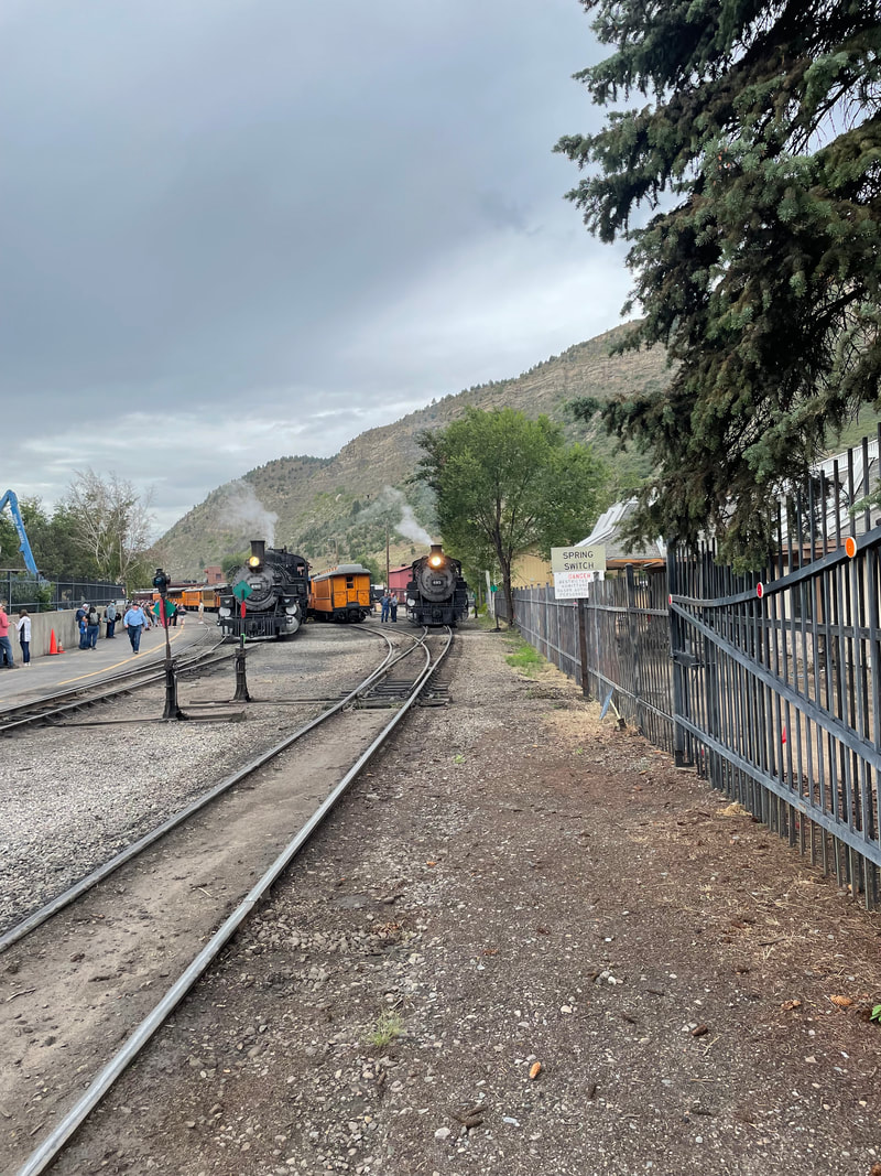
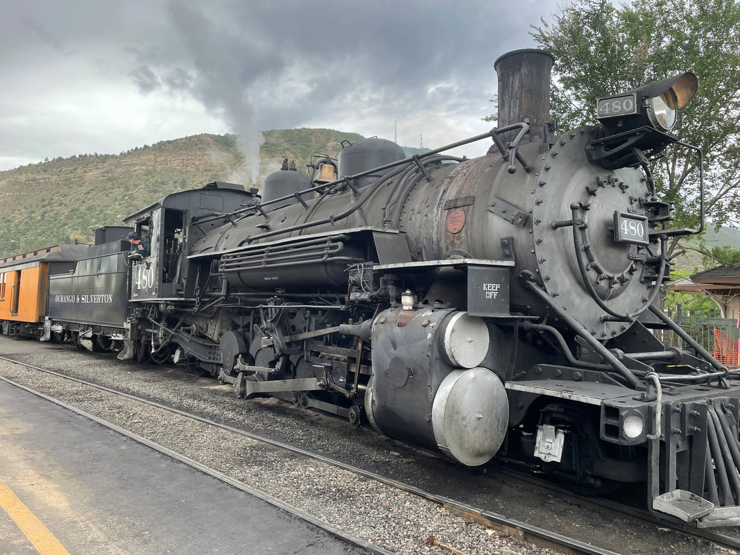
When we got to Silverton, we decided to break for lunch. We went to a little restaurant and had Philly Cheesesteaks, which were very good. It was the first time Mom got one. Though she had some difficulty because her meat kept falling out without the cheese to hold it in. 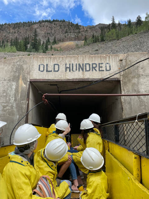 After lunch we went to the Old Hundred Gold Mine for a tour. We arrived just in time to catch the tour. They were loading up to leave when we got there. It was also lucky that Mom had cash because their credit card machine wasn’t working. They gave us rain ponchos and helmets and then we joined the rest of the group in the mining carts.
After we were back outside, I showed Mom how to pan for gold. Basically, you have 2 bowls with ridges and you pour the mud back and forth until all you have left is the gold flakes. Gold is naturally heavier than dirt, so it settles to the bottom. After we finished at the mine we decided to go back to the condo to get packed so we can leave early tomorrow. Since I enjoyed the view on the way to Silverton, I offered to drive so Mom could also see it all. She created videos to send to her siblings and panned the camera down to capture the steep drops. But then she had to stop because she felt like she was going over the cliff when she watched the videos. As long as she didn’t look down, she was fine. When we got back to town we went back to the condo to get ready for our long drive tomorrow.
One of the reasons I wanted to go to Durango was to visit Mesa Verde National Park. I have a National Park book, and I’m trying to go to all of them. It was about a 45 minute drive to the park from where we were staying, but the views were beautiful. When we got there, we went to the welcome center so I could get my stamp. There were a lot of people waiting in line to go in. They were only allowing a set amount of people to be inside at a time because of covid. After waiting in line for a while, one of the rangers told me a separate table was set up with the stamp, so I went over there and then we went back to the car to go to our hiking spot.
We have another long drive ahead of us. It will take about 9 hours to get to Durango and our AirBNB for the night. We got an early start and then started driving. And driving and driving. There wasn’t much to see along the way, mainly just fields. As we got closer to Colorado we did start to see more mountains. We decided to pass through Clayton, New Mexico on the way. This was the place were my grandmother was raised. It was your typical small town, there and gone in the blink of an eye. We did get to see the mountains that the locals call “rabbit ears” because they look like rabbit ears.
After we finished our little hike, we continued on the drive. It was a long drive to Durango, but we did eventually make it. However, we regretted not stopping for dinner because by the time we got to the room and got settled, all of the restaurants had closed or were closing soon. But we weren’t super hungry so we decided to pass on food for the night.
Today Mom and I are starting our trip to Colorado. We were originally supposed to be going on an Alaskan cruise but the cruise line cancelled it because Canada was still closed. I’ve heard that it is planning on reopening next week, so I guess it is a good thing the cruise got cancelled. We debated going to New Orleans, but I’m glad we held off on that because there has been a huge increase in cases of covid due to the new delta variant and New Orleans is one of the hot spots.
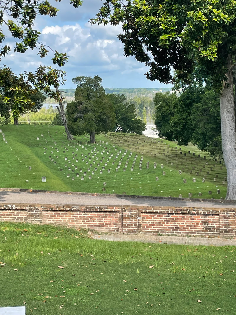
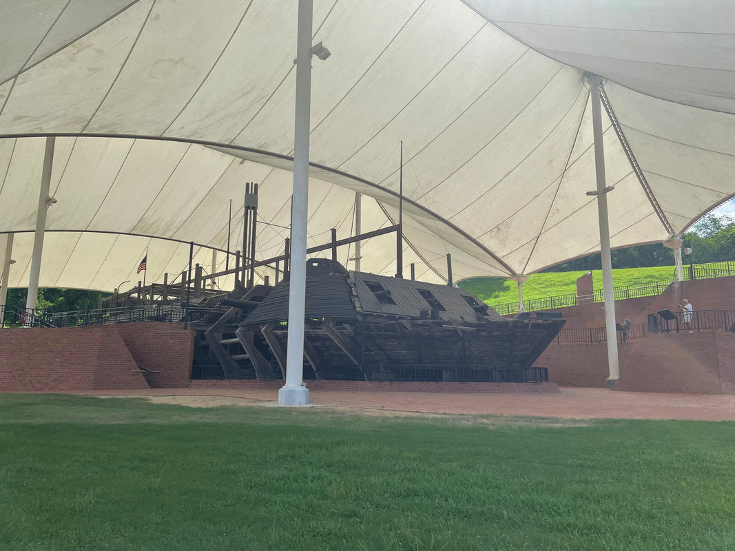
Mom was off today so she drove up from San Antonio to Dallas. I had originally planned on taking off, but I had some unexpected issues with a client so I ended up working until noon when I snuck out. We went and picked up the rental car from Enterprise and then we hit the road. Since we were leaving a noon, we knew we wouldn’t make it all the way to Colorado, but we wanted to get a least a little bit down the road to brake up the long drive. We drove about 5.5 hours and made it to Borger, which is close to Amarillo. And then we called it a night. Today is sadly going to be my last day of traveling. I’ll be sleeping in my own bed tonight. To start my last day, I went to Vicksburg National Military Park. The town of Vicksburg was very important to both the North and the South. Whoever controlled Vicksburg controlled the lower half of the Mississippi River. While the South held it, they could move supplies and hold the Confederacy together. If the North controlled it, the Southern states of Texas, Arkansas, and most of Louisiana would be cut off. In October 1862, the Union turned its attention to capturing Vicksburg in order to control all of the Mississippi River. They tried different attacks, but eventually realized that only a siege would be successful. In the Spring of 1863, they start surrounding the town. As the months pass, there were several battles as the Union army kept getting closer and closer to the city. The formal siege began on May 18 and lasted until July 4 when Vicksburg officially surrendered.
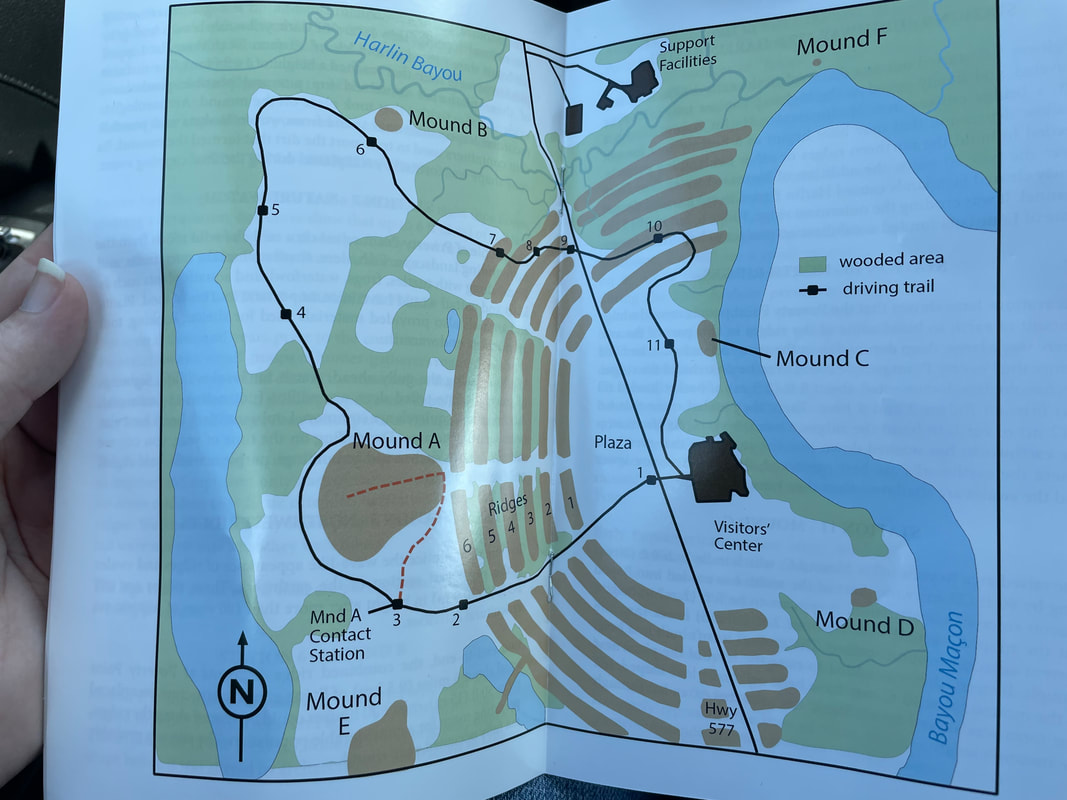
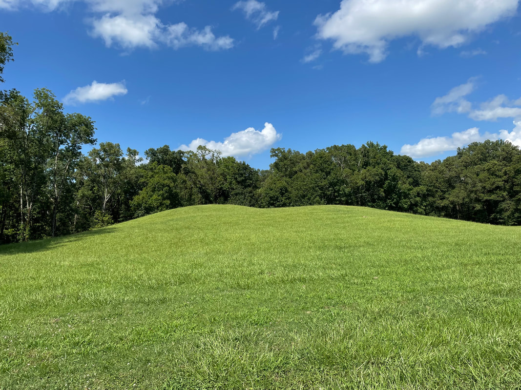
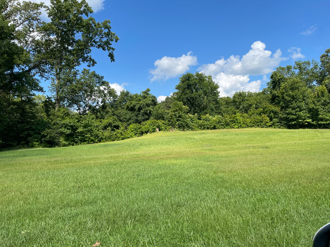
My next stop as I got close to the boarder was Emerald Mound. Emerald Mound is the second-largest Mississippian Period ceremonial mound in the U.S., surpassed by only Monk’s Mound in Cahokia. It was built and used between the years 1200 C.E. and 1730 C.E. It is 35 feet high and covers 8 acres. Archaeologists believe the mounds were the setting for elaborate civic processions, ceremonial dances, and religious rituals. It is still used by the local Native Americans in ceremonies today.
Next, I crossed over the border into Louisiana to go to Natchez National Historical Park. The park is made up of 3 sites: Melrose, William Johnson House, and Fort Rosalie. Melrose I have actually been to before but they had reduced hours due to covid so I couldn’t go there. And the William Johnson was known as the “Barber of Natchez” so I wasn’t very interested in him. I decided to go to Fort Rosalie, but there really wasn’t much to see. When I talked to the lady at the visitor center, she told me they were in a legal battle for years over the land. That finally ended at the end of 2019, and before construction or anything could be done covid hit and it halted everything.
As I drove to the first mound, you could barely see the ridges. The central construction consists of 6 rows of concentric ridges. The ridges form a C-shape divided into sections by 4 aisles. It is thought that the ridges served as foundations for dwellings but little evidence of this has been found.
After I finished my driving tour I decided to drive home. It was about a 5 hour drive, so it took a while, but I arrived home at about 10pm so at least I could sleep in my own bed for the night and not pay for another hotel room. Since I arrived late, I’ll have to return my rental car tomorrow. I had an amazing 3-week adventure and though I’m glad to be home I can’t wait for my next one.
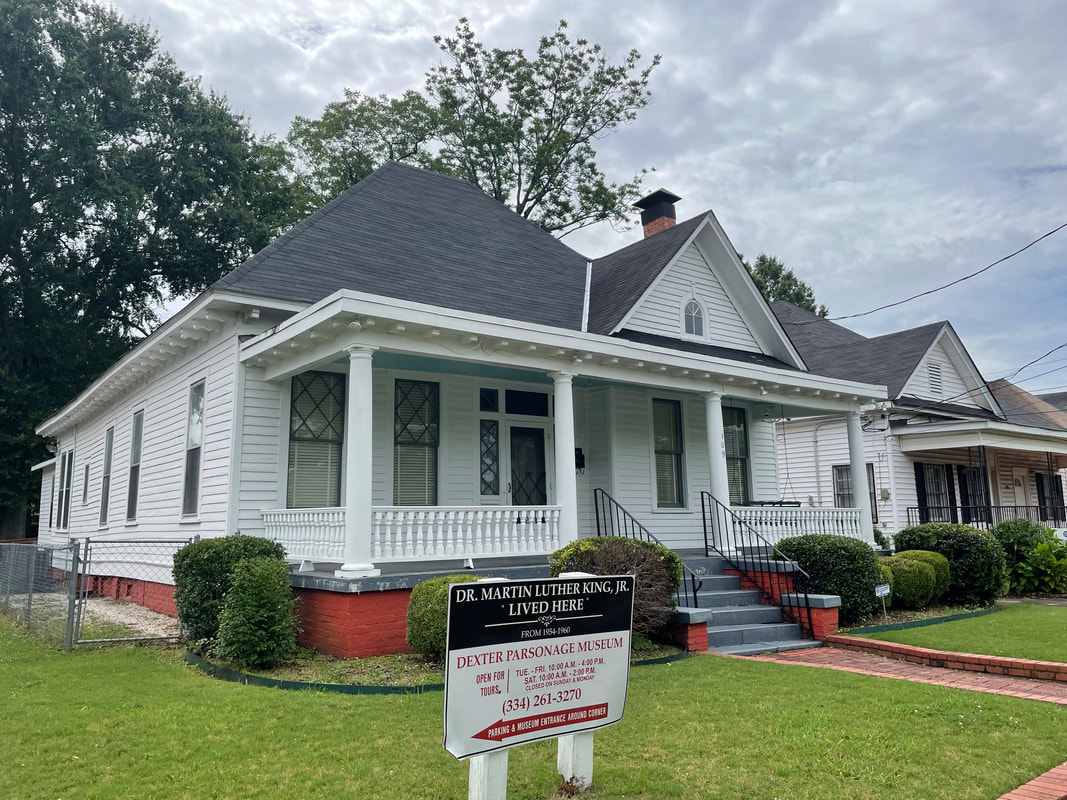
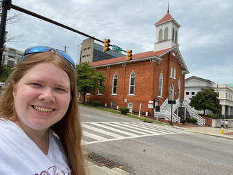 After I finished walking around I decided to walk to the Freedom Rides Museum since I still had plenty of time left on the clock for my parking. It didn’t take as long as I thought it would to see the White House and the Capitol building. Along the way I passed by Dexter Avenue King Memorial Baptist Church, which was only a few blocks from the Capitol. This was the place that Dr. Martin Luther King Jr. was the pastor from 1954 to 1960. This is also where he directed the Montgomery Bus Boycott.
I finished in Montgomery a lot earlier than I had expected, so I decided to continue on to Jackson, Mississippi. The only thing I had planned on seeing here was the Mississippi Civil Rights Museum. Since I got there about an hour before they closed, they allowed me to enter for free. The museum is massive and it is actually 2 museums.
They also had more recent displays, talking about plantations and the Civil War. They didn’t go into a ton of detail about this, probably because the Civil Rights Museum does. It also had displays covering all the way up until today. Since I didn’t have a lot of time, I had to rush through them and I didn’t get to read everything. But it must take hours to go through everything for those museums! Since this was my only stop in Jackson, I continued across the state to my hotel for the night.
My first stop for the day is the Ocmulgee Mounds National Historic Park. I have actually been to several mound sites, like Cahokia. I didn’t realize that the Mississippian civilization stretched all the way to Georgia. Archaeologists know that the town was abandoned as early as 1100 CE, but they do not know why. They also know that the descendants of these people eventually became known as the Muscogee or Creek Indians.
By the time I finished going through the museum it was time to watch the movie and learn about Andersonville National Historic Site. What I learned was not good. It was a Confederate prisoner of war camp. Basically the land was turned into a huge outdoor jail. Prisoners had to make due with what they came in with to make tents. At the beginning of the war there were prisoner exchanges, so the North and South would exchange prisoners. The problem was these soldiers returned to duty and the North felt they prolonged the war, so they put a halt to them. As the war drug on, food supplies became scarce as the men were away at war and could not till the fields and the North raided into the South burning fields and destroying what crops were planted. At the same time, camps like Andersonville became more and more crowded as they reached and exceeded double the capacity that they were supposed to hold. Rations became scarce for the guards, let alone the prisoners. There was a water supply, but as more and more prisoners joined the camp it became dirty and was insufficient for the amount of people shoved together. Thousands died and were buried in unmarked graves on the grounds until the war finally ended and they were freed. Sadly, this was normal for prisoner of war camps on both the Union and Confederate side. However, Andersonville was the largest Confederate POW camp and got the reputation as one of the worst. After the war ended, Captain Henry Wirz was tried for war crimes and executed. The only good thing to come from Andersonville is that it sparked the formation of the Red Cross. One of the prisoners was Dorence Atwater, and after the war he returned to Andersonville with Clara Barton. Atwater had kept a secret list of the nearly 13,000 POWs that died at Andersonville and where they were buried. Barton was already known as the “Angel of the Battlefield” for her help with the wounded after battle and with her work of gathering medical supplies. When she visited Andersonville she helped Atwater identify all of the graves put grave markers on them. Afterwards, she traveled to Europe and helped found an international medical disaster organization which would eventually become the American Red Cross that we know of today. It is amazing how one event can change a person’s life forever, and continue to impact people today.
My first stop for the day was at Fort Frederica. Since I didn’t know anything about the fort, I watched the NPS video first. In the 1700s, both Spain and England claimed the land between St. Augustine and Charleston; the state that is now Georgia. With Spanish power in North America waning, England decided found a colony on this disputed territory. Led by James Oglethorpe (who eventually settled on Cumberland Island), colonists built a fort. The town was named for Frederick, the king’s only son. Under Oglethorpe’s direction, the colonists built the fort and then the town around it. Over the years, the colonists grew for a couple hundred to a town of over 500 people. In 1742, the Spanish decided it was time to reclaim their land. Spanish commander Manuel de Montiano, governor of Florida, decided to destroy Frederica and lay waste the coast up to South Carolina. Spanish ships carrying 2,000 men landed a few miles up the inland passage by Fort Frederica. Oglethrope retreated to the fort, and when 200 Spaniards advanced up the military road Oglethrope routed the column with a fierce attack. Learning of the repulse, Montiano sent several hundred men to cover the retreat but they ran into a British ambush. Legend has it that the marsh ran red with blood, when in reality only a few men died. However, the battle was called the Battle of Bloody Marsh and was the last Spanish invasion north of Florida. It also spelled the eventual decline of the town. With the threat from Spain gone, the British disbanded the military that was stationed there. Without the support of several hundred soldiers’ pay, the town fell in decline and is now a ruin.
After Isaiah died, the family’s wealth declined with no income coming in and Isaiah’s widow had to sell off their belongings and eventually the house in order to get by. The next owners owned it for 109 years until the house was in decline. It was going to be demolished until the Historic Savannah Foundation bought it.
A couple of blocks from the Davenport house was the Owens-Thomas House & Slave Quarters. This was my next stop, but when I got there the next tour didn’t start for another 45 minutes. So I bought my ticket and then went walked a couple of blocks down to Subway to eat some lunch while I waited. By the time I got back it was time to start my tour. Instead of having a tour guide, they have an audio guide. You scan a QR Code with your phone and then you can listen to each area as you walk through the house.
After I finished walking around I went back to my car and drove to Fort Pulaski for my last stop of the day. Fort Pulaski was a Civil War era fort, and it was considered unbreachable. So it was a shock when the Confederate commander was forced to surrender it. By April 1861, 11 Southern states had left the Union and were at war with the North. By November, Fort Pulaski was under attack as the North tightened the blockades around Southern ports. While the Confederates controlled Fort Pulaski, the North controlled the batteries around it on Tybee Island. However, the Confederates weren’t concerned because they were being bombared by ammunition from a mile away. What they didn’t know was that the North was using 10 experimental rifled canons, which began to bore through Pulaski’s walls. After 30 hours of bombardment, Confederate commander Colonel Charles Olmstead surrendered when the holes threated the main powder magazine.
I had a plan for the day. My first stop was going to be Cumberland Island, and then I was going to drive up the coast of Georgia to hit the other National Parks. However, when I was looking up where Cumberland Island was I quickly realized that wasn’t going to happen. The only way to get to Cumberland Island is by ferry, and today there was only 1 ferry going to the island and 1 coming back. If you miss the ferry you are stuck on the island. So I quickly changed my plans to spend the whole day on the island. I didn’t reserve a ferry ticket ahead of time, so I was on the standby list. I waited until the boat was going to head to the island and I guess some people didn’t show up so I was able to go. While I was waiting in line, I looked up what I could do since I was going to spend all day there and I decided to sign up for the tour of the island. Before the boat left, I ran back to my car for my umbrella since the day was overcast. On my way back I saw a sign right where I was parked saying that there was a 2 hour limit or my car would be towed. I panicked, but there was nothing I could do. The ferry was minutes from leaving and if I missed it I couldn’t catch another one. I literally had no time to move my car. I hope no one notices…
When we got to the island I went and joined my group for the tour. They had a van, so we all loaded up in there for our tour of the island. I quickly found out that apparently this was a famous island, and there were several books written about it. The guide would ask a question and everyone knew the answer except me. The island was originally settled by the Spanish, but was eventually abandoned due to pirate attacks. English general James Oglethorpe arrived in 1733 and established a hunting lodge on the island. A fort was built to defend the English settlements north of Spanish Florida. After the English defeated the Spanish in 1742 the forts were no longer needed and were abandoned. Later it was divided into parcels with different owners. Nathanael Greene, a Revolutionary War hero, ended up founding most of southern Cumberland Island. After he died, his widow Catharine Greene, inherited it. She remarried Phineas Miller 10 years later and they built a huge mansion on the island that they called Dungeness and was the site of many social galas. The Millers were the first major planters on the island and they owned over 200 slaves. They employed a man named Eli Whitney, who invented the cotton gin with their financial help in 1793. Catharine Green was also friends with General “Lighthorse” Harry Lee, who was the father of Robert E. Lee, and she took him in when he was ill. He ended up dying on the island and was buried here until he was reinterred at Lexington, Virginia in 1913.
On our way, our guide told us about how the island became a National Park. In the late 1950s, some members of the Carnegie family invited the National Park Service to the island to assess its suitability as a National Seashore. Plans were underway to declare it as a National Seashore. This was complicated in 1968 when several Carnegie descendants sold 3,000 acres to real estate developer Charles Fraser, who wanted to develop it as park of Hilton Head Island. The remaining Carnegie and Candler descendants didn’t want their island to become developed, so they banded together with politicians, activities, and non-profit organizations to stop it. They helped push a bill through Congress to establish Cumberland Island as a National Seashore and all of the owners of the island sold to the federal government. However, several of the owner still wanted access to the islands and their private retreats, so they created property rights. Each of the owners have separate agreements with the NPS. Basically, they own their houses and the land for a set number of years and after the term is up the NPS will own it. It is complicated because each family had different lawyers and they all negotiated for different terms.
The other famous owners on this island where the Carnegies. In the late 1880s, Thomas Carnegie, brother of steel magnate Andrew Carnegie, and his wife Lucy bought land on Cumberland for a winter retreat. In 1884, they started building a mansion on the site of Dungeness. Thomas ended up dying before the mansion was finished, but Lucy and their 9 children continued living on the island. Before it became a national park, the Carnegies owned 90% of the island. According to our guide, Lucy was a helicopter mom and wanted to remain in control of her children. To do this, she promised she would build them their own homes as long as they lived on the island. Several of her children took her up on the offer and there are 3 other mansions on the island now. One of them was Greyfield, which was built for Margaret Carnegie Ricketson and her husband Oliver Ricketson. It is now known as Greyfield Inn, and is an inn for the wealthy. It costs about $400 a night for a room and you have to stay for a minimum of 3 nights. I didn’t get a picture of it, but we passed by it on our way to the northern part of the island. The Stafford Planation is still privately owned by members of the Carnegie family. The one that we were able to visit was Plum Orchard, which was built for Thomas M. Carnegie and his wife Margaret Copley Thaw. This is the only mansion built on the northern part of the island by the Carnegies, and it was because Margaret and Lucy did not get along. Margaret wanted to be as far as possible from her. Margaret also wanted everything she had to be better than Lucy’s. So she had an extra wing built at Plum Orchard so it would be bigger than Lucy’s house. And when Lucy got an ice maker, Margaret also had to have one but it had to be bigger. After Thomas died, Margaret ended up remarrying and moving to Kenya.
After the ranger session, the ferry arrive and I returned back to the mainland. The ferry was a lot more crowded, so there were several people inside the cabin. Apparently the mask mandate is flexible, because I saw several people not wearing them inside. We got back after 6pm and I went straight to my car to make sure it was still there. And it was! I even walked around it to make sure I didn’t get a boot, and luckily it didn’t so I was able to continue on my way to my hotel for the night.
|
Categories
All
Archives
June 2022
AuthorThese are details from my adventures around the world. |
| Cory's Travel Blog |
|
- Blog
- About
- Europe
- Africa
- Asia
-
The Americas
-
North America
>
- Mexico
-
United States
>
- Alabama
- California
- Colorado
- Connecticut
- Delaware
- Florida
- Georgia
- Hawaii
- Illinois
- Indiana
- Iowa
- Kansas
- Kentucky
- Louisiana
- Maine
- Maryland
- Massachusetts
- Mississippi
- Missouri
- Nebraska
- Nevada
- New Hampshire
- New Mexico
- North Carolina
- New Jersey
- Ohio
- Oklahoma
- Pennsylvania
- Rhode Island
- South Carolina
- Texas
- Virginia
- Washington D.C.
- South America >
- Central America >
-
North America
>
- Oceania
- Special Attractions
 RSS Feed
