Colorado Springs
|
|
Garden of the Gods
|
|
|
Seven Falls
Back before Seven Falls was officially known as Seven Falls, it was a chunk of land given to Nathan Colby in 1872 as part of the Homestead Act. The land that contained Seven Falls was 160 acres and Mr. Colby promptly flipped the tract, selling it to James Hull. Hull collected other land around the falls and by the time he died and his estate was deeded to his sons, his land holdings had climbed to 1,400 acres. The second Seven Falls flood re-shaped the park forever. In 2013, five days of immense rain stuck the Pikes Peak region. The water running through Cheyenne Creek and surrounding streams was referred to as a “500-year flood” with water levels so catastrophic that it destroyed the visitor park andthe road leading to Seven Falls. Trees were upended, pavement completely disappeared and mud plagued the region. Despite the best efforts of the Walker family, who owned the land at the time, the park was forced to close for over two years until its ultimate sale to the Broadmoor Hotel just down the road. The Broadmoor re-opened Seven Falls on August 13, 2015. The site now features remote parking at the hotel, with a shuttle bus to the canyon.The sum of the height of the seven falls is 181 feet (55 m) and there are a total of 224 steps on the staircase from the base of the falls to the peak. |
Denver
Capitol Building
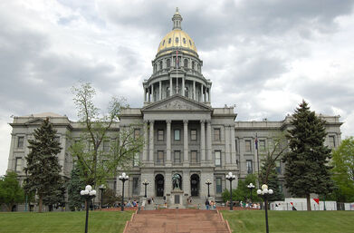
The Colorado State Capitol was constructed in the 1890s and opened in November 1894. It is the home of the Colorado General Assembly, and the offices of the Governor, Lieutenant Governor, and Treasurer. Designed by architect Elijah E. Myers, the building is intentionally reminiscent of the United States Capitol, constructed of Colorado white granite and topped with its distinctive gold dome. The dome itself is covered in copper panels that are gilded with gold leaf from a Colorado mine. The inside of the building is adorned with what is believed to be the entire known supply of Colorado Rose Onyx, a rare rose marble. White Yule Marble was also used throughout the building for the floors. Many of the Colorado State Capitol's windows are stained glass, depicting people and events related to the history of Colorado. The official elevation of Denver is measured on the West steps outside the building, where the fifteenth step is engraved with the words "One Mile Above Sea Level." A second mile high marker was set in the 18th step in 1969 when Colorado State University students resurveyed the elevation. In 2003, a more accurate measurement was made with modern means, and the 13th step was identified as being one mile (1.6km) high, where a third marker was installed.
The Colorado State Capitol was constructed in the 1890s and opened in November 1894. It is the home of the Colorado General Assembly, and the offices of the Governor, Lieutenant Governor, and Treasurer. Designed by architect Elijah E. Myers, the building is intentionally reminiscent of the United States Capitol, constructed of Colorado white granite and topped with its distinctive gold dome. The dome itself is covered in copper panels that are gilded with gold leaf from a Colorado mine. The inside of the building is adorned with what is believed to be the entire known supply of Colorado Rose Onyx, a rare rose marble. White Yule Marble was also used throughout the building for the floors. Many of the Colorado State Capitol's windows are stained glass, depicting people and events related to the history of Colorado. The official elevation of Denver is measured on the West steps outside the building, where the fifteenth step is engraved with the words "One Mile Above Sea Level." A second mile high marker was set in the 18th step in 1969 when Colorado State University students resurveyed the elevation. In 2003, a more accurate measurement was made with modern means, and the 13th step was identified as being one mile (1.6km) high, where a third marker was installed.
Durango
|
|
Durango/Silverton Railroad
|
|
|
Million Dollar Highway
|
Estes Park
|
|
Twin Sisters Peak
The Twin Sisters Peaks are mountains in Colorado, located in the Front Range in Larimer County, Colorado, straddling Rocky Mountain National Park and Roosevelt National Forest. Twin Sisters Peak Trail is a 7.5 mile heavily trafficked out and back trail located near Estes Park, Colorado that offers the chance to see wildlife and is rated as difficult. The trail is primarily used for hiking, horses, and snowshoeing. |
|
Rocky Mountain National Park
|
|
Georgetown
|
|
Georgetown Railroad
|
Golden
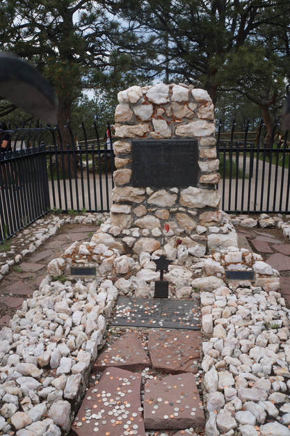
Buffalo Bill Grave
|
|
Buffalo Bill Museum
|
|
Coors Brewery
|
|
|
|
Lookout Mountain
|
Idaho Springs
Mount Evans |
|
Manitou Springs
|
|
Cave of the Winds
|
|
Manitou Cliff Dwelling
|
|
Mesa Verde
|
|
Mesa Verde National Park
|
Morrison
|
|
Dinosaur Ridge
The rock layers that make up Dinosaur Ridge contain many millions of years of history. During the Jurassic period,(145 to 201 million years ago), the area that is now Colorado consisted of a low plain crossed by slow-moving rivers. Dinosaurs lived and died along the rivers. About 110 to 70 million years ago during the Cretaceous period, eastern Colorado was submerged under an inland sea. This area served as a “freeway” for dinosaurs migrating along the western edge of the inland sea. As sea levels continued to rise, much of Colorado was eventually under water. About 65 million years ago the sea drained, and a sudden uplift formed huge mountains where the Rockies are today. This activity tilted the old inland seabed at up to a 45-degree angle. Around 40 million years ago the mountains began to erode. A volcanic period buried them under ash. About 5 million years ago a period of intense erosion began, washing away softer rock layers to reveal the much older and harder rocks that make up the Rocky Mountains. The old tilted seabed layers came to the surface as a long chain of ridges, In 1937 construction workers discovered dinosaur tracks in rock layers on the east side of the ridge. New excavations and maps of the tracks in 1992–93 revealed a total of 335 tracks and 37 trackways. Ten different rock strata contain tracks, with at least 78 individual dinosaurs represented in tracks preserved on the ridge. All these tracks were made about 100 million years ago, when the dinosaurs were migrating north and south on the “Dinosaur Freeway” along the shore of the ancient inland sea. |
|
|
Red Rocks Amphitheatre
|
Roxborough
|
|
Roxborough State Park
In 1889 Henry S. Persse acquired land and renamed the area “Roxborough” after the part of Ireland from which his family had emigrated. In the 1920s, the Persses sold their Roxborough land to the Helmer family, which had been farming and ranching adjacent land east of the hogback and north of Roxborough since 1880. The area continued to be used for ranching for another fifty years. In 1975 the Colorado Division of Parks and Outdoor Recreation bought 500 acres of land in the area to establish Roxborough State Park. By that time, excavations had showed that the hogback valley was a popular spot for prehistoric occupations in the Archaic and Ceramic periods because of its mild climate, large rock outcrops, diverse plant and animal resources, and convenient location between the mountains and the plains. The survey revealed artifacts dating from the Early Archaic period to the Early Ceramic period (150–1150 CE). On May 15, 1987, Roxborough State Park opened to the public. Today the park preserves nearly 3,300 acres on the southwestern edge of the Denver metropolitan area. |
Silverton
|
|
One Hundred Gold Mine
|
